Mapinfo Professional v.10 Full

Mapinfo Professional 10 Full | Mirror Mediafire
MapInfo Professional expands location intelligence:
See your business data in powerful new ways
-Discover trends hidden in spreadsheets and charts
-Gain new understanding of your customers and markets
-Perform powerful data analysis and calculations
-Create custom maps and content for analysis
Use geographic insights to innovate business processes
-Manage location-based assets, people and property
-Optimize service and sales territories for greater efficiencies
-Deploy networks, infrastructure and utilities with confidence
-Map resources, plan logistics and prepare for emergencies
Works and plays well with existing IT infrastructure
-Designed and tested with Windows operating systems
-Imports and exports data in a wide variety of formats
-Easily customized to meet your specific needs
Download FIle : here

MapBasic 9.0
 The flexible development environment for MapInfo Professional®
The MapBasic® development environment is a complete, BASIC-like programming language used to create custom applications for use with MapInfo Professional® or special MapInfo runtimes. MapBasic allows you to customize the geographic functionality of MapInfo Professional, automate repetitive operations, and integrate MapInfo Professional with other applications – quickly and easily.
* Build custom applications and modify the MapInfo Professional interface
* Control MapInfo Professional through OLE Automation
* Add 'a little mapping' to your applications with MapInfo Professional windows
* Create and edit programs with MapBasic Text Editor
* Use MapBasic Compiler to create an executable from a program
* Link separate program modules for large or complex applications
* Reference On-line Help for the MapBasic language
* Includes over 300 statements and functions
Download File
Password : free-gis-archive.blogspot.com
Discover Mapinfo Plugin
 Encom Discover is the desktop Geographical Information System (GIS) designed especially for the geosciences, providing the tools to effectively compile, visualise, analyse and map spatial geoscience data.
Since its release in 1994, Discover with MapInfo Professional has become the GIS of choice for geologists, environmental scientists, cartographers, exploration managers and database administrators.
Features
*build geological datasets
*produce high-quality scaled geological maps, with titleblocks, map grids, legends, structural symbols, etc
*compile drillhole data and create cross-sections, plans and logs
*create, filter, contour, profile, manipulate, colour and analyse gridded surfaces
*analyse and visualise geochemical data
*rectify unprojected raster images
*create graphs with maintained spatial links for interactive analysis
*enhance your GIS productivity via an extensive range of data, object, table and map windows utilities
*connect to other geological systems, databases and file formats
*control the MapInfo Professional workspace with a real-time, enhanced layer control
*produce exploration tenement applications (Australia only)
*optionally display your GIS data in 3D (Discover 3D)
*integrate with a field GIS (Discover Mobile)
System Requirements
Encom Discover requires MapInfo Professional 7.0 to 9.5 for Windows 2000, XP or Vista.
Download File : Discover 4.01 Part1, Part2
Password : free-gis-archive.blogspot.com
MapInfo Professional v9.0 Build 42 Portable
MapInfo Professional v9.0 Build 42 Portable MapInfo Professional is a powerful Microsoft Windows-based mapping application that enables business analysts and GIS professionals to easily visualize the relationships between data and geography. With MapInfo Professional, you can perform sophisticated and detailed data analysis by leveraging the power of location. Including location in your decision making and daily operations can help you increase revenue, lower costs, boost efficiency and improve services.
Use MapInfo Professional to:
- Create highly detailed maps to enhance presentations and aid in decision making
- Reveal patterns and trends in your data that may otherwise be impossible to see in spreadsheets and charts
- Perform sophisticated and extensive data analysis
- Understand customer and marketplace demographics
- Manage geographically based assets, such as stores, people and property
- Plan logistics and prepare for emergency response
Run it from any device, no installation required. All in English
Download File : Part1, Part2, PArt3, Part4
Password : free-gis-archive.blogspot.com
Vertical Mapper 3.0
 Enhance geographic data analysis and visualization with the power of grids. Working seamlessly within MapInfo Professional, Vertical Mapper is unmatched as an effective tool to display, manage, and interpret spatial information. Optimize the location of broadcast towers, analyze health issues, visualize elevation, model environmental data, target marketing campaigns, determine centres of criminal activity – the possibilities are endless. Vertical Mapper lets you turn data into valuable information for making better decisions.
Key Advantages
 Create Grids
Vertical Mapper features modeling tools and a full suite of interpolators based on all standard estimation principles that let you build continuous surfaces, or grids, from existing point files or unmapped tables, regardless of data type. Easy-to-use wizards help novice users achieve meaningful answers while experienced mappers can adjust advanced settings to obtain more sophisticated results.
Display Grids
Visualize trends in spatial information easily. Vertical Mapper grid colour settings define data variations and dynamic 3D rendering tools let you bring data to life. View multiple grids within the same scene, apply drapes to any open grid, and determine the degree of transparency for both grids and drape files. Vertical Mapper gives you a wealth of display options to generate impressive and intelligent data representations.
Analyze Grids
Enter a whole new world of geographic analysis made possible through grid technology. Whether you need to query and compare multiple layers of information, use complex mathematical expressions to create derivative grids, or perform line of sight analysis with the ViewShed function, Vertical Mapper has robust spatial analysis capabilities that help you gain new insight from your data.
Download File
Password : free-gis-archive.blogspot.com
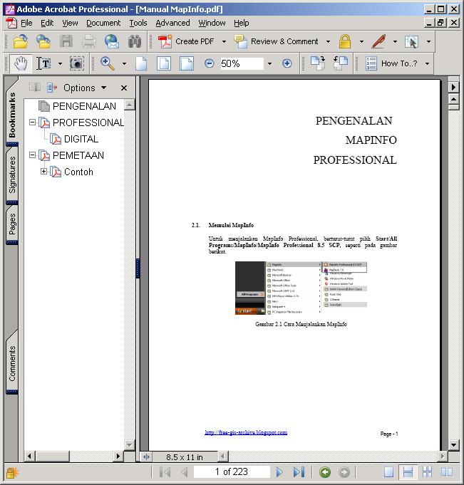
Manual Mapinfo Full Indonesia

MapInfo location intelligence enables you to answer a fundamental, yet complex question faced by nearly all organizations: Where? It's a critical factor in countless strategic and operational decisions in business and the public sector. Associating your organizational data with location is the foundation for making critical decisions that improve performance.
===============================================
Manual penggunaan mapinfo dari tingkat dasar dalam bahasa indonesia sebanyak 233 halaman.
Download file, password : free-gis-archive.blogspot.com
ECW for MapInfo
Ecw Compressor merupakan software untuk kompresi data raster hingga 10% nya, contoh image raster ikonos 200Mb menjadi 20Mb dengan kualitas yang tetap sama. Untuk membuka file format *.ecw harus di install terlebih dahulu MapImagery.
ECW for MapInfo is a raster handler plugin for MapInfo Professional and MapX, developed by MapImagery, which enables these products to read ECW, compressed images.
ECW is a wavelet compression standard developed by Earth Resource Mapping that provides high quality image compression. Many data and software vendors are adopting ECW as their standard image compression technique.
In addition to local, or network server ECW files, ECW for MapInfo allows you to display Image Web Server images from Internet or Intranet servers.
ECW for MapInfo is distributed in 2 different ways. As part of MapImagery, a MapInfo Professional image analysis plugin, from MapImagery Limited. And as a stand-alone product, which is included on the MapInfo Professional and MapX CDROMs, under utilities.
MapImagery has a free version, and a low cost commercial version with extra features. Both the free and commercial versions have some GUI features making it easier to work with ECW images. Both versions can be downloaded from the MapImagery web page.
Download and Install
The ECW for MapInfo is distributed as a self extracting executable archive. To install ECW for MapInfo under Windows 95 or Windows NT (or later) perform the following steps:
Make sure you have MapInfo Professional 5.0 or later installed on your PC.
Unless you have a very good reason, it is better to download the MapImagery self extracting archive, rather than the ECW for MapInfo one, as MapImagery is a superset of ECW for MapInfo , providing a useful GUI for working with ECW images..
Download the latest MapImagery self extracting distribution file from MapImagery Download (6 megabytes). If you just want ECW for MapInfo, this is available as a separate download, as well as being part of MapImagery from here ECW for MapInfo Download (1.18 megabytes). Note that the version numbers on these download archives relate to the internal version numbering of MapImagery products, and not to MapInfo version numbers.
Run the downloaded file by typing its name at a dos prompt, or double clicking on its icon in a file manager. After unzipping the files, the installation program will run, and will guide you through the installation process.
Follow the setup program instructions. You will be asked for the location of your MapInfo software (for example, C:\MAPINFO) and for the location to install MapImagery
Download File
Password : free-gis-archive.blogspot.com
MapImagery and MapImagery Professional
MapImagery merupakan software Plugin yang terinstall pada Mapinfo untuk membuka format file Raster.
MapImagery is a free plugin for MapInfo users that provides tools making it easier to use imagery within MapInfo Professional. MapImagery supports a wide range of raster image formats and makes it simpler to use these formats within MapInfo Professional by automatically extracting registration information, where this is available.
MapImagery has strong support for working with ECW compressed images and Image Web Server URL images. In addition, MapImagery enables ER Mapper algorithms, prepared via ER Mapper or MapImagery Professional, to be displayed, and integrated with vector information, within MapInfo Professional.

MapImagery Professional is an upgrade to MapImagery, that provides an advanced set of raster tools, usually only available in high cost dedicated image processing products. MapImagery Professional can be used for preparing, adjusting and enhancing imagery, for use within MapInfo Professional based applications.
The additional features of MapImagery Professional can be activated via the entry of a software key, which can be purchased from the MapImagery web site or from Earth Resource Mapping.
Both MapImagery and MapImagery Professional use proven ER Mapper technology as a basis, so you can depend on their quality and strength. What this also provides is an upgrade path for power users, to the leading professional imaging product, ER Mapper.
Compatibility with a whole range of free imaging plug-ins also makes it simple to integrate MapImagery and MapImagery Professional into your organization wide GIS strategy
Download File
Password : free-gis-archive.blogspot.com
ErMapper Plugin ArcView 3.x
Plugin ini merupakan extension tambahan untuk software ArcView agar dapat membuka format file raster seperti halnya MapImagery pada mapinfo.
Earth Resource Mapping announced today the latest release of the free ECW plugin for ArcGIS® 8.1, 8.1.2 and 8.2. The plug-in allows greater productivity in the ArcGIS® environment by adding support for ECW, URL, ALG and ERS image formats. It also includes the 500MB (not 50MB) ECW compressor utility for free.
The most significant new features and improvements for this release are:
· Significant improvement in the display\process speed of imagery. ECW is now easily the fastest and most efficient format for compressed large imagery in the ArcGIS® Desktop environment.
· The ability to add remote ECW imagery to your project served by the Image Web Server. This functionality is a key feature of the ArcView® 3.x plug-in, and is now available in ArcGIS® environment.
· The addition of ER Mapper''s ALG and ERS formats. No longer are ER Mapper users and their clients restricted to ArcView 3.x plug-in for their GIS projects. Also, virtual datasets (e.g. ERS->TIFF) can now be added to your projects.
· New toolbar and commands provide a user-friendly interface, access to plug-in features and customisation of workspace. Some of the commands on the toolbar include, add remote ECW, launch ECW compressor, plug-in options, access to help documentation and about dialog.
· Better integration with ECW compressor. The ECW compressor can be accessed via command or export menu "Raster to ECW…". As the compressor is a separate process, compression tasks can be carried out without restricting workflow in the ArcGIS® environment. Other advantages include robustness and the ability for compression to continue while ArcGIS® is closed.
· Comprehensive help documentation with illustrations provides a useful resource for new users or who want to get the most from the plug-in.
Stuart Nixon CEO and Founder of Earth Resource Mapping said "This latest release of the free ECW plugin for ArcIMS confirms our continued support for GIS users. The ability to use images stored remotely on an Image Web Server adds an exciting capability to the ECW plugin for ArcIMS®." Mr Nixon went on to note that ECW has become widely used by ArcView® and ArcGIS® users because of its speed and the free 500MB ECW Compressor.
To download the free ECW plugin for ArcGIS® 8.1, 8.1.2 and 8.2, visit http://www.ermapper.com/downloads.
About Earth Resource Mapping
Earth Resource Mapping is the world''s leading image handling and integrated mapping software company. Clients in more than 120 countries use ER Mapper to prepare imagery, ECW to compress and use imagery, and the Image Web Server to serve imagery over the Internet.
About ESRI®
ESRI®, ArcGIS®, ArcView®, and ArcInfo® are trademarks or registered trademarks of Environmental Systems Research Institute, Inc. This announcement of ECW plugins by Earth Resource Mapping for ESRI® products does not imply an endorsement of the plugins by ESRI®.
Download File
Password : free-gis-archive.blogspot.com
Popular Posts
-
 MapInfo location intelligence enables you to answer a fundamental, yet complex question faced by nearly all organizations: Where? It's a...
-
 AutoDesk AutoCAD Map 3D 2010 | 3.18 GB AutoCAD® Map 3D software enables engineers, planners, mapping technicians, surveyors, and GIS prof...
-
 ArcEngine Developer Kit 9.3 Full | Rapidshare 24 Part ArcGIS 9.3 Engine Developer kit + Runtime Highlights * Support for Visual Stu...
-
 Mapinfo MapXtreme 2008 | 124 mB | rapidshare MapInfo MapXtreme can put mapping applications into the hands of anyone with access to a web...
-
 Leica GEO OFFICE 8.3.0.0.13017 GNSS - FULL With Leica Geo Office use the most powerful tools all integrated in one common soft...
-
 PCI Geomatic 9.1 Full Geomatica Focus – a state-of-the-art work environment that includes a fully georeferenced, file-based visualization to...
-
 National Geographic Maps Complete Collection - 8 CD ISO OS: Windows | CD ROM - 8 CDs | 5.06 GB Travel around the globe and through time with...
-
 Google Said " Over the last 10 years, businesses, scientists and hobbyists from all over the world have been using Google Earth Pro...
-
 ISBN: 0764569333 | Year: 2004 | PDF | 14.6 MB | 408 Pages Basic GPS principles and concepts such as waypoints, routes, tracks, and coordi...
-
 Portable Universal Maps Downloader v4.0|| 1.95MB Universal Maps Downloader is a tool that help you to get small tile images from google...


