ArcEngine Developer Kit v.9.3 Full

ArcEngine Developer Kit 9.3 Full | Rapidshare 24 Part
Highlights
* Support for Visual Studio 2008 and Eclipse 3.3 IDEs
* New tools and performance enhancements for dynamic display
* Improved documentation, including new resource center
ArcGIS Engine 9.3 delivers a standard framework for developers to build focused custom GIS and mapping applications. With the new version, developers will find it easier than ever to find and use the code samples, documentation, and tools that are necessary to be successful. It enables developers to rapidly build GIS solutions that take full advantage of ESRI's ArcGIS platform.

Surfer 8.0 Full

Surfer 8.0 Full | Rapidshare
Download link : here
Surpac 6.0 Full

Surpac 6.0 Full | rapidshare
Surpac offers integrated tools for Mineral exploration and resource modelling,Mine planning and feasibility including design scheduling,Mine production, incorporating drill and blast management,surveying,grade control
HOW TO INSTALL :
1. install java runtime, flash player and prequisite software
2. Disable antivirus dan network
3. Copy patch to the folder bin (bin \ Surpac.6.0.Patch-*******. exe).
4. run patch and apply for local license
Link download Installer :http://www.gemcomsoftware.com/files/6/surpac_60.msi
Prerequist: http://www.gemcomsoftware.com/files/63/prerequisites.msi
Patch: here
Mapinfo MapXtreme 2008
 Mapinfo MapXtreme 2008 | 124 mB | rapidshare
MapInfo MapXtreme can put mapping applications into the hands of anyone with access to a web browser. With a simple click, customers can see their wireless coverage area, find the closest drug store or get driving directions to their next sales calls. And network engineers can visually spot disruptions in their network - automatically notifying customers of service outages.MapInfo MapXtreme enables organizations to visualize and analyze data to discover new relationships and trends not apparent using traditional methods, such as spreadsheets and reports.
Bentley PowerMap XM v08.09.04.84
 Bentley PowerMap XM v08.09.04.84 | 260Mb | Mirror
Bentley PowerMap provides a rich 2D or 3D map production environment. You can work in DGN or DWG files, natively read and reference SHP file formats, and import a wide range of industry-standard raster and vector file formats.To assist your production workflows, a range of topological analysis tools are available. Like Bentley Map, the topology model is based on, but does not require, the Oracle Spatial topology model and Bentley PowerMap offers all the same topological analysis and spatial operations found in Bentley Map. Because Bentley PowerMap and Bentley Map are based on the same code base, they share many of the same features and functions including:
* The intuitive Map Manager
* XML Feature Modeling
* The Geospatial Administrator
* Oracle Spatial editing
* On-the-fly or on-demand topology
* Spatial analysis and presentation
* Map generation and print preparation
* Map projection and coordinate conversion
* High performance display of industry standard image formats
* Interoperability with other GIS formats including ESRI, MapInfo, and more
Mapinfo Professional v.10 Full

Mapinfo Professional 10 Full | Mirror Mediafire
MapInfo Professional expands location intelligence:
See your business data in powerful new ways
-Discover trends hidden in spreadsheets and charts
-Gain new understanding of your customers and markets
-Perform powerful data analysis and calculations
-Create custom maps and content for analysis
Use geographic insights to innovate business processes
-Manage location-based assets, people and property
-Optimize service and sales territories for greater efficiencies
-Deploy networks, infrastructure and utilities with confidence
-Map resources, plan logistics and prepare for emergencies
Works and plays well with existing IT infrastructure
-Designed and tested with Windows operating systems
-Imports and exports data in a wide variety of formats
-Easily customized to meet your specific needs
Download FIle : here
ENVI 4.5
 ENVI 4.5 | Software Image Processing
http://gudangpeta.4shared.com

Dari pada koleksi peta Berjamur, Rusak, Hilang, lebih baik di sharing, siapa tahu ada yang memerlukan dan akan lebih bermanfaat.
Leica.Geo.Office.V.7.0.Build.9009-ENGiNE
 Leica.Geo.Office.V.7.0.Build.9009-ENGiNE
LEICA Geo Office is based on an intuitive, graphical interface within a Windows™ multitasking environment making it very easy to learn and use.
All components have a similar look and feel and interact seamlessly with each other. GPS, TPS and level data are handled in a similar way with standardized tools and dataflow. The embedded HELP contains useful tutorials and provides advice and information whenever needed. LEICA Geo Office assists you at every step.
PCI GEOMATIC 9.1
 PCI Geomatic 9.1 Full
Geomatica Focus – a state-of-the-art work environment that includes a fully georeferenced, file-based visualization tool including editing in an easy-to-use interface.
The power of Geomatica OrthoEngine technology for efficient production of geometrically corrected images and mosaics.
Cartographic map production. Standard image processing capabilities including:
Image enhancements
Filtering
Resampling, reprojection and clipping
Optical satellite image analysis including:
Atmospheric correction
Pixel-based image classification
Contextual/fuzzy classification
Neural network classification
Spectral unmixing
Attribute management tools for analysis with your data including:
Attribute Manager for viewing, editing and querying
Charting
Direct access to more than 100 geospatial data formats through the PCI Geomatics exclusive Generic Database (GDB) technology.
3-D perspective scene generation and fly-through
Download File : Part1, Part2, Part3, Part4
Password : pcijfm
PROLINK SOKKIA
 PROLINK SOKKIA SOFTWARE | 14 Mb
Your Link Between Field and Office
ProLINK software is your link between the field and office; facilitating the exchange of data between data collectors and various software packages. ProLINK provides the necessary tools to import, convert, reduce and export a variety of raw data formats.
Customized imports and exports Survey Data Management
ProLINKs functionality as an intelligent raw data editor for GPS/RTK and Total Station survey data is enhanced by its capability to transform into a wide range of file formats. ProLINK software requires a properly activated hardware security device for full functionality. ProLINK edits, reduces and manages survey project data. ProLINK can be customized to define a variety of file formats for importing and exporting by using ProLINKs powerful Conversion Definition Manager.
Survey Data Management
ProLINK contends with data from Total Station surveys, GPS/RTK surveys or both. The data can be manually input, imported from a wide variety of file formats (SDR, MOSS, SDMS, ASCII) or received directly from an Electronic Total Station or from a data collector such as the SDR Electronic Field Book.
Data Editing
ProLINK incorporates intelligent data editing, which maintains the integrity of your data. You can insert, modify or delete records and the software will automatically update the reduced data view.
Reduction
ProLINK will reduce your raw data to coordinates. Reduction parameters are applied to individual field books. The results display in list format and can be easily exported.
Transformation
As a part of the reduction process, a coordinate transformation can be applied to field books independently. The transformation parameters can be directly input or calculated based on manually input coordinates or selected project coordinates. The same transformation tool can be used to determine horizontal and vertical calibration values for GPS/RTK projects.
Coordinate Systems
You can simply select a local coordinate system to transform your ETS and RTK data. Choose from several predefined local coordinate systems or define your own. These coordinate systems can even be sent to your SDR data collector and selected directly in the field.
Data Output and Communications
The importing and exporting of data is greatly enhanced with the capability to communicate with a variety of external devices. Additionally, you can export raw data or results. The output can meet a variety of specifications by employing conversion files during export. ProLINK not only offers several import (SDR, MOSS, SDMS, ASCII) and export (SDR, DXF, MOSS, ICS, SDMS, ASCII) conversion formats, it allows you to define your own.
Conversion Definition Manager
ProLINKs Conversion Definition Manager is a comprehensive tool for creating conversion files, which can be used to import data to or from ProLINK. You can map records and fields from the external format to ProLINK records and fields, as well as from ProLINKs format to an external format.
Download File : Sokkia Prolink
CIFOR - Sistem Informasi Geografis Untuk Pengelolaan Sumberdaya Alam
 CIFOR - Sistem Informasi Geografis Untuk Pengelolaan Sumberdaya Alam
CD iso | 303 Mb | ISBN 979-3361-33-6
Record Type:Book
Author:Puntodewo, A.; Dewi, S.; Tarigan, J.
Subject (Topic):geographical information systems, natural resources, resource management, computer techniques, data processing, mapping, handbooks, training, spatial data
Physical Description:viii, 127p.; ill.
Publisher:CIFOR, Bogor, Indonesia.
Publication Year:2003
Language:indonesian
ISBN:979-3361-33-6
GPS for Dummies
 ISBN: 0764569333 | Year: 2004 | PDF | 14.6 MB | 408 Pages
Basic GPS principles and concepts such as waypoints, routes, tracks, and coordinate systems
Recommended features for GPS receivers to be used in various types of activities, including hiking, mountain biking, cross country skiing, geocaching, hunting, ATVing, mapping, and more
How to do digital mapping on your computer, including software packages you can use to work with aerial photos, topographic maps, and road maps
The main providers of digital map data for the U.S. and their Web sites
The scoop on geocaching?????a high-tech treasure hunt
Global Mapper 10.02.DC032809
 Global Mapper 10.02.DC032809 | 28.74 MB
Costumize Google Map and Google Earth

Google Map and Google Earth | ebook | 7 Mb
Get ready for some down-and-dirty hackin'! Over 200 serious hacks readers can use to force Windows XP to do it their way, written in the ExtremeTech no-holds-barred style
Sinchak doesn't waste time tweaking Movie Maker or Instant Messenger-these hacks are heavy-duty, detailed instructions for squeezing every drop of power from Windows XP and maximizing speed, appearance, and security
Not for the faint of heart! This book is written for users who aren't afraid to roll up their sleeves, risk voiding their warranties, take total control of the task bar, uninstall programs that are supposedly permanent, and beef up boot speed
AutoDesk AutoCAD Map 3D 2010
 AutoDesk AutoCAD Map 3D 2010 | 3.18 GB
AutoCAD Map 3D mapping software is one of the leading engineering platforms for creating and managing spatial data and bridges the gap between CAD and GIS. AutoCAD Map 3D makes it possible for engineering and GIS professionals to work with the same data, and helps you integrate geospatial functions in a single environment for more efficient workflows.
Earth and Map Vector
 7 AI | 16 EPS | 31.8 Mb RAR
Download file : http://rapidshare.com/files/215583648/Earth.Map.rar
Category:
art design,
download
National Geographic Maps Complete Collection - 8 CD ISO

National Geographic Maps Complete Collection - 8 CD ISO
OS: Windows | CD ROM - 8 CDs | 5.06 GB
OS: Windows | CD ROM - 8 CDs | 5.06 GB
Travel around the globe and through time with this exceptional all-inclusive collection of historic maps. Contains every fold-out map from 1888 to December 2000. The CD-ROM format lets you browse through over 500 maps, take guided tours, and print out. Also features audio enhancements as well as advanced search options. A timeless topographic compilation that allows you to fully explore the magnificence of our ever-changing world.
The Complete Collection, over 500 maps with zoom, search, printing facility with audio, video and full photo. More than a century of National Geographic maps. Take a wondrous journey around some of the Worlds most incredible locations. Explore the world around you at the touch of a button. Whether your interest lies in culture, history or the environment, interactive time lines trace key events and provide fascinating stories about the people and places behind this very exceptional and stunning collection of maps.
The Complete Collection, over 500 maps with zoom, search, printing facility with audio, video and full photo. More than a century of National Geographic maps. Take a wondrous journey around some of the Worlds most incredible locations. Explore the world around you at the touch of a button. Whether your interest lies in culture, history or the environment, interactive time lines trace key events and provide fascinating stories about the people and places behind this very exceptional and stunning collection of maps.
First class search engine - search simply by keywords, geographic location or by theme. Advanced mapping technology to view, pan and zoom for a global or a close up view. The maps can easily be pasted into your documents or printed in either black & white or vivid colour. Interesting facts on animals, plant life, the environment, politics, history, the ocean and space. Guided thematic tours - explore a range of topics and thrilling stories including - People of the Past, War in the 20th Century, Our Changing Earth, Space and Our Threatened Environment.
DISK-1/INSTALLATION
http://rapidshare.com/files/129627995/install.part1.rar
http://rapidshare.com/files/129628456/install.part2.rar
http://rapidshare.com/files/129634418/install.part3.rar
http://rapidshare.com/files/129332728/install.part4.rar
http://rapidshare.com/files/129635352/install.part5.rar
http://rapidshare.com/files/129699081/install.part5.rar
http://rapidshare.com/files/129335895/install.part6.rar
DISK 2
http://rapidshare.com/files/129305086/disk2.part1.rar
http://rapidshare.com/files/129304882/disk2.part2.rar
http://rapidshare.com/files/129305691/disk2.part3.rar
http://rapidshare.com/files/129306039/disk2.part4.rar
http://rapidshare.com/files/129306284/disk2.part5.rar
http://rapidshare.com/files/129307172/disk2.part6.rar
http://rapidshare.com/files/129304791/disk2.part7.rar
DISK 3
http://rapidshare.com/files/129307670/disk3.part1.rar
http://rapidshare.com/files/129308430/disk3.part2.rar
http://rapidshare.com/files/129309087/disk3.part3.rar
http://rapidshare.com/files/129309215/disk3.part4.rar
http://rapidshare.com/files/129309468/disk3.part5.rar
http://rapidshare.com/files/129308929/disk3.part6.rar
http://rapidshare.com/files/129309758/disk3.part7.rar
DISK 4
http://rapidshare.com/files/129310167/disk4.part1.rar
http://rapidshare.com/files/129310743/disk4.part2.rar
http://rapidshare.com/files/129311305/disk4.part3.rar
http://rapidshare.com/files/129333336/disk4.part4.rar
http://rapidshare.com/files/129334184/disk4.part5.rar
http://rapidshare.com/files/129333346/disk4.part6.rar
http://rapidshare.com/files/129694651/disk4.part7.rar
http://rapidshare.com/files/129346266/disk4.part8.rar
DISK 5
http://rapidshare.com/files/129348503/disk5.part1.rar
http://rapidshare.com/files/129351361/disk5.part2.rar
http://rapidshare.com/files/129309915/disk5.part3.rar
http://rapidshare.com/files/129455030/disk5.part4.rar
http://rapidshare.com/files/129455717/disk5.part5.rar
http://rapidshare.com/files/129456878/disk5.part6.rar
http://rapidshare.com/files/129458436/disk5.part7.rar
http://rapidshare.com/files/129458817/disk5.part8.rar
DISK 6
http://rapidshare.com/files/129461847/disk6.part1.rar
http://rapidshare.com/files/129468401/disk6.part2.rar
http://rapidshare.com/files/129470271/disk6.part3.rar
http://rapidshare.com/files/129470816/disk6.part4.rar
http://rapidshare.com/files/129471730/disk6.part5.rar
http://rapidshare.com/files/129914030/disk6.part6.rar
http://rapidshare.com/files/129475076/disk6.part7.rar
DISK 7
http://rapidshare.com/files/129314394/disk7.part1.rar
http://rapidshare.com/files/129476116/disk7.part2.rar
http://rapidshare.com/files/129478476/disk7.part3.rar
http://rapidshare.com/files/129574251/disk7.part4.rar
http://rapidshare.com/files/129636866/disk7.part5.rar
http://rapidshare.com/files/129587644/disk7.part6.rar
http://rapidshare.com/files/129591570/disk7.part7.rar
DISK 8
http://rapidshare.com/files/129326222/disk8.part1.rar
http://rapidshare.com/files/129624951/disk8.part2.rar
http://rapidshare.com/files/129595483/disk8.part3.rar
http://rapidshare.com/files/129599057/disk8.part4.rar
http://rapidshare.com/files/129626026/disk8.part5.rar
http://rapidshare.com/files/129627017/disk8.part6.rar
http://rapidshare.com/files/129701399/disk8.part7.rar
GIS for DUMMIES

360 pages | PDF| 6 Mb | 4shared
GIS (geographic information system) is a totally cool technology that has been called “geography on steroids.” GIS is what lets you see the schools in your neighborhood or tells you where the nearest McDonald’s is. GIS For Dummies tells you all about mapping terminology and digital mapping, how to locate geographic features and analyze patterns such as streets and waterways, and how to generate travel directions, customer location lists, and much more with GIS.
Whether you’re in charge of creating GIS applications for your business or you simply love maps, you’ll find GIS For Dummies is packed with information. For example, you can:
- Learn all the hardware and software necessary to collect, analyze, and manipulate GIS data- Explore the difference between 2D and 3D maps, create a map, or manage multiple maps
- Analyze patterns that appear in maps and interpret the results
- Measure distance in absolute, comparative, and functional ways
- Recognize how spatial factors relate to geographic data
- Discover how GIS is used in business, the military, city planning, emergency services, land management, and more
- Find out how GIS can help you find out where flooding may occur
- Determine what your organization needs, do appropriate analyses, and actually plan and design a GIS system
Download file, Password: free-gis-archive.blogspot.com
Portable Universal Maps Downloader v.4.0
 Portable Universal Maps Downloader v4.0|| 1.95MB
Universal Maps Downloader is a tool that help you to get small tile images from google maps, yahoo maps or microsoft maps. All downloaded small images are saved on the disk. You can view downloaded maps by Maps Viewer Or you can combine them into a big BMP map by Maps Combiner.
Popular Posts
-
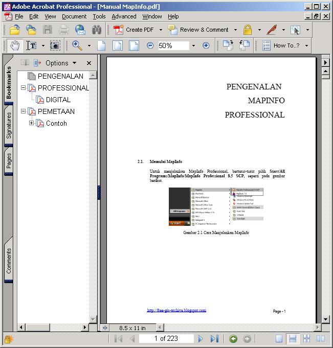 MapInfo location intelligence enables you to answer a fundamental, yet complex question faced by nearly all organizations: Where? It's a...
-
 AutoDesk AutoCAD Map 3D 2010 | 3.18 GB AutoCAD® Map 3D software enables engineers, planners, mapping technicians, surveyors, and GIS prof...
-
 ArcEngine Developer Kit 9.3 Full | Rapidshare 24 Part ArcGIS 9.3 Engine Developer kit + Runtime Highlights * Support for Visual Stu...
-
 Mapinfo MapXtreme 2008 | 124 mB | rapidshare MapInfo MapXtreme can put mapping applications into the hands of anyone with access to a web...
-
 Leica GEO OFFICE 8.3.0.0.13017 GNSS - FULL With Leica Geo Office use the most powerful tools all integrated in one common soft...
-
 PCI Geomatic 9.1 Full Geomatica Focus – a state-of-the-art work environment that includes a fully georeferenced, file-based visualization to...
-
 National Geographic Maps Complete Collection - 8 CD ISO OS: Windows | CD ROM - 8 CDs | 5.06 GB Travel around the globe and through time with...
-
 Google Said " Over the last 10 years, businesses, scientists and hobbyists from all over the world have been using Google Earth Pro...
-
 ISBN: 0764569333 | Year: 2004 | PDF | 14.6 MB | 408 Pages Basic GPS principles and concepts such as waypoints, routes, tracks, and coordi...
-
 Portable Universal Maps Downloader v4.0|| 1.95MB Universal Maps Downloader is a tool that help you to get small tile images from google...


