CIFOR - Sistem Informasi Geografis Untuk Pengelolaan Sumberdaya Alam
 CIFOR - Sistem Informasi Geografis Untuk Pengelolaan Sumberdaya Alam
Record Type:Book
Author:Puntodewo, A.; Dewi, S.; Tarigan, J.
Subject (Topic):geographical information systems, natural resources, resource management, computer techniques, data processing, mapping, handbooks, training, spatial data
Physical Description:viii, 127p.; ill.
Publisher:CIFOR, Bogor, Indonesia.
Publication Year:2003
Language:indonesian
ISBN:979-3361-33-6

GPS for Dummies
 ISBN: 0764569333 | Year: 2004 | PDF | 14.6 MB | 408 Pages
Basic GPS principles and concepts such as waypoints, routes, tracks, and coordinate systems
Recommended features for GPS receivers to be used in various types of activities, including hiking, mountain biking, cross country skiing, geocaching, hunting, ATVing, mapping, and more
How to do digital mapping on your computer, including software packages you can use to work with aerial photos, topographic maps, and road maps
The main providers of digital map data for the U.S. and their Web sites
The scoop on geocaching?????a high-tech treasure hunt
Costumize Google Map and Google Earth

Google Map and Google Earth | ebook | 7 Mb
Get ready for some down-and-dirty hackin'! Over 200 serious hacks readers can use to force Windows XP to do it their way, written in the ExtremeTech no-holds-barred style
Sinchak doesn't waste time tweaking Movie Maker or Instant Messenger-these hacks are heavy-duty, detailed instructions for squeezing every drop of power from Windows XP and maximizing speed, appearance, and security
Not for the faint of heart! This book is written for users who aren't afraid to roll up their sleeves, risk voiding their warranties, take total control of the task bar, uninstall programs that are supposedly permanent, and beef up boot speed
GIS for DUMMIES

- Explore the difference between 2D and 3D maps, create a map, or manage multiple maps
- Analyze patterns that appear in maps and interpret the results
- Measure distance in absolute, comparative, and functional ways
- Recognize how spatial factors relate to geographic data
- Discover how GIS is used in business, the military, city planning, emergency services, land management, and more
- Find out how GIS can help you find out where flooding may occur
- Determine what your organization needs, do appropriate analyses, and actually plan and design a GIS system
An Introduction to PHP for Scientists and Engineers: Beyond JavaScript
 An Introduction to PHP for Scientists and Engineers: Beyond JavaScript 141 pages | Springer; 1 edition (September 5, 2008) | 184800236X | PDF | 2 Mb
PHP, originally created in 1994 as a ‘Personal Home Page’ tool, is a server-side programming language that can be used to solve numerous computing problems that a client-side language like JavaScript cannot.
This highly useful text/reference presents key information needed to write your own online science and engineering applications, including reading, creating and manipulating data files stored as text on a server, thereby overcoming the limitations of a client-side language. This book focuses on those elements of the language - such as file input/output, arrays, built-in math functions, and user-created functions - that are essential for solving a wide range of scientific/engineering computing problems. It assumes a working knowledge of HTML, programming concepts, and JavaScript, C or a similar language.
Esri ArcEngine Developers Guide
 ESRI® ArcGIS® Engine is a platform for building custom stand-alone geographic information systems (GIS) applications which support multiple applicationprogramming interfaces (APIs), include advanced GIS functionality, and are builtusing industry standards.
This chapter will introduce you, the developer, to the ArcGIS Engine developer kit and the ArcGIS Engine Runtime, discussing how to use it and its different components.
Topics covered in this chapter include:
• an overview of ArcGIS 9
• introduction to ArcGIS Engine
• ArcGIS Engine users
• capabilities of ArcGIS Engine
• a description of this book
Download File : Esri ArcEngine Developers Guide (16Mb)
Programming ArcObject with VBA
 Introduction
This book is designed for ArcGIS users who want to get a quick start on programming
ArcObjects. Both ArcGIS and ArcObjects are products developed and distributed
by Environmental Systems Research Institute Inc. (ESRI), ArcObjects is the development
platform for ArcGIS, a software package for managing geographic information
systems (GIS). Ideally, users should learn ArcObjects before using ArcGIS,
but that is not the case in reality. Users use ArcGIS first through its toolbars and
commands. It is easier to follow the user interface in ArcGIS than to sort out objects,
properties, and methods in code. The topic of ArcObjects usually emerges when
users realize that programming ArcObjects can actually reduce the amount of repetitive
work, streamline the workflow, and even produce functionalities that are not
easily available in ArcGIS.
How can users learn programming ArcObjects efficiently and quickly? Perhaps
surprising to some, the answer is to apply what users already know about ArcGIS
to programming ArcObjects.
basics, and customization. This book adopts Visual Basic for Applications
(VBA) for programming ArcObjects. Because VBA is already embedded within
ArcMap and ArcCatalog, it is convenient for ArcGIS users to program ArcObjects
in VBA. The following summarizes the major topics covered in the first three
chapters:
• Chapter 1: ArcObjects — Geodatabase, ArcObjects, organization of ArcObjects,
the help sources on ArcObjects, and the Geoprocessing object.
• Chapter 2: Programming Basics — Basic elements, writing code, calling subs and
functions, Visual Basic Editor, and debugging code.
• Chapter 3: Customization of the User Interface — Creating a toolbar with existing
commands, adding a new button and tool, adding a form, and making basic
templates.
Chapters 4 through 14 discuss programming ArcObjects for solving common
GIS tasks. Organized around a central theme, each chapter has three parts. The first
part is a quick review of ArcGIS commands on the topic; the second part discusses
objects that are related to the theme; and the third part presents sample macros and
Geoprocessing macros for solving common tasks under the theme. This combination
of ArcGIS commands, ArcObjects, and sample macros can effectively relate the
user’s experience of working with ArcGIS to programming ArcObjects.
The CD that accompanies this book contains 95 sample macros stored in the
VBA_programs folder by chapter. Each sample macro starts with a short description
of its usage and a list of key interfaces and members (properties and methods). These
are followed by the listing and explanation of code. Many macros are divided into
two or more parts to better connect the code lines and their explanation. Stored as
text files, these sample macros can be easily imported to Visual Basic Editor in either
ArcMap or ArcCatalog to view and run.
The companion CD also includes 33 Geoprocessing macros that are new in this
second edition. These macros are stored in the GP_programs folder by chapter. The
Geoprocessing object is a new ArcObjects component that supports the execution of
hundreds of Geoprocessing tools in a scripting language such as VBA or Python. These
tools are the same as in the ArcToolbox application of ArcGIS Desktop. The Geoprocessing
object is a “coarse-grained” object, which is simpler to use than a “fine-grained”
object. Therefore it allows users who do not understand all the details of ArcObjects
to run macros. To separate them from “regular” VBA macros, Geoprocessing macros
are included in “boxes” in Chapters 4 through 7 and in Chapters 9 through 14.
All sample macros in the text have been run successfully in ArcGIS 9.2. The
companion CD contains datasets for the test runs, which are stored by chapter in
the Data folder. Two notes must be made about use of the sample macros. First,
ArcGIS 9.1 or 9.2 is needed to run the macros. Second, the Data folder is coded in
the sample macros as residing on the C drive (for example, c:\data\chap4). If the
folder is stored on a different drive (for example, the G drive), then the path should
be changed (for example, g:\data\chap4) before running the macros.
The following summarizes the major tasks covered in each chapter:
• Chapter 4: Dataset and Layer Management — Add datasets as layers, manage
layers and datasets, and report geographic dataset information.
• Chapter 5: Attribute Data Management — List fields, add or delete fields, calculate
field values, and join and relate tables.
• Chapter 6: Data Conversion — Convert shapefile to geodatabase, convert coverage
to geodatabase and shapefile, perform rasterization and vectorization, and add XY
data.
• Chapter 7: Coordinate Systems — Manipulate on-the-fly projection, define the
coordinate system, perform geographic transformation, and project datasets.
• Chapter 8: Data Display — Display vector data, display raster data, and create a
layout page.
• Chapter 9: Data Exploration — Perform attribute query, perform spatial query,
combine attribute and spatial queries, and derive descriptive statistics.
• Chapter 10: Vector Data Operations — Run buffer, perform overlay, join data by
location, and manipulate features.
• Chapter 11: Raster Data Operations — Manage raster data and perform local,
neighborhood, zonal, and distance measure operations.
• Chapter 12: Terrain Mapping and Analysis — Derive contour, slope, aspect, and
hillshade; perform viewshed analysis; perform watershed analysis; and create and
edit triangulated irregular networks (TIN).
• Chapter 13: Spatial Interpolation — Perform spatial interpolation and compare
interpolation methods.
• Chapter 14: Binary and Index Models — Build binary and index models, both
vector and raster based.
Download File
Password : free-gis-archive.blogspot.com
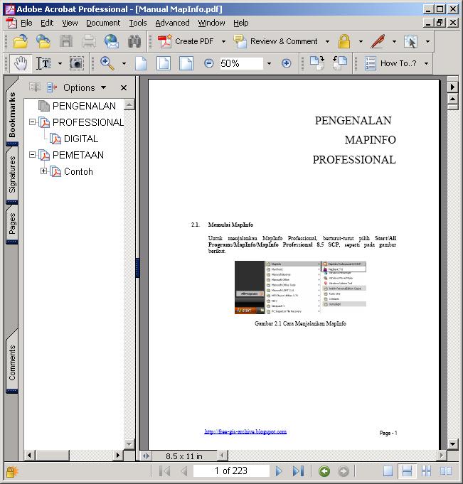
Manual Mapinfo Full Indonesia

MapInfo location intelligence enables you to answer a fundamental, yet complex question faced by nearly all organizations: Where? It's a critical factor in countless strategic and operational decisions in business and the public sector. Associating your organizational data with location is the foundation for making critical decisions that improve performance.
===============================================
Manual penggunaan mapinfo dari tingkat dasar dalam bahasa indonesia sebanyak 233 halaman.
Download file, password : free-gis-archive.blogspot.com
Modul ArcVIew 3.x (Bhs Indonesia)
Bagi para pengguna produk esri, sebelum lahirnya ArcGis 9.2 yang begitu lengkap akan feature nya sebelumnya esri merilis terlebih dulu ArcView 3.0, ArcView 3.1, ArcView 3.2 hingga terakhir ArcView 3.3.
With ArcView you can
- Integrate and share data across your organization.
- Work with your data geographically—seeing undetected patterns, revealing hidden trends and distributions, and gaining new insights.
- Map customer and competitor site locations.
- Understand relationships between the forces that drive your business, and make better decisions to solve business problems faster and smarter.
- Publish intelligent maps and create interactive map presentations by linking charts, tables, drawings, photographs, and other files.
- Develop custom tools, interfaces, and complete applications.
Download file
Popular Posts
-
 MapInfo location intelligence enables you to answer a fundamental, yet complex question faced by nearly all organizations: Where? It's a...
 -
 AutoDesk AutoCAD Map 3D 2010 | 3.18 GB AutoCAD® Map 3D software enables engineers, planners, mapping technicians, surveyors, and GIS prof...
 -
 ArcEngine Developer Kit 9.3 Full | Rapidshare 24 Part ArcGIS 9.3 Engine Developer kit + Runtime Highlights * Support for Visual Stu...
 -
 Mapinfo MapXtreme 2008 | 124 mB | rapidshare MapInfo MapXtreme can put mapping applications into the hands of anyone with access to a web...
 -
 Leica GEO OFFICE 8.3.0.0.13017 GNSS - FULL With Leica Geo Office use the most powerful tools all integrated in one common soft...
 -
 PCI Geomatic 9.1 Full Geomatica Focus – a state-of-the-art work environment that includes a fully georeferenced, file-based visualization to...
 -
 National Geographic Maps Complete Collection - 8 CD ISO OS: Windows | CD ROM - 8 CDs | 5.06 GB Travel around the globe and through time with...
 -
 Google Said " Over the last 10 years, businesses, scientists and hobbyists from all over the world have been using Google Earth Pro...
 -
 ISBN: 0764569333 | Year: 2004 | PDF | 14.6 MB | 408 Pages Basic GPS principles and concepts such as waypoints, routes, tracks, and coordi...
 -
 Portable Universal Maps Downloader v4.0|| 1.95MB Universal Maps Downloader is a tool that help you to get small tile images from google...


