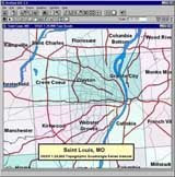
Esri - ArcView 3.3
 New in ArcView 3.3- application level
* Support for PC ARC/INFO 4.0 double-precision coverages.
* ArcView Projection Utility-- the updated ArcView Projection Utility offers up to three times faster projecting and reprojecting of shapefiles in addition to faster start-up times for the utility (Windows® only).
New in ArcView 3.3- data integration utilities
* SDTS Data Import-- at ArcView 3.3, the SDTS raster import utility has been updated to support the latest raster profile types released by the United States Geological Survey (USGS).
New in ArcView 3.3 - extensions
 * CAD Reader extension-- updated with improved support for AutoCAD® 2000 (Release 15) and AutoCAD 2002 drawing and DXF files (Windows only).
* Database Access extension-- Database Access 2.1d expands the data reading capabilities of ArcView 3.3 by allowing it to connect to the latest ArcSDE spatial data server. The Database Access extension also allows ArcView 3.3 to utilize the ArcSDE Direct Connect configuration option to connect to spatial data in Oracle® or Microsoft®'s SQL Server without an ArcSDE application server being present. Direct Connect with the Database Access extension requires an ArcSDE server connection license.
* ERDAS IMAGINE Image extension-- updated support for ERDAS® IMAGINE® 8.5. The ERDAS IMAGINE Image extension also adds the capability to read pyramid layers. Pyramid layers allow for quick display of very large images. The extension can only read pyramid layers already created for an IMAGINE image. Pyramid layers can be created using ERDAS IMAGINE or ESRI® ArcGIS Desktop products (ArcView 8, ArcEditor 8, or ArcInfo 8).
* NITF Image Support extension-- the NITF Image Support extension has been enhanced to read all images in NTF format as well as rotated NITF images. A sample script to read annotation is also included.
* Report Writer extension-- ArcView 3.3 includes Crystal Decisions' (formerly Seagate) Crystal Reports® version 8.5. Web reports and integration with Microsoft Office are key new features of Crystal Reports 8.5 (Windows only).
Download File : Part1, Part2, Part3, Part4, Part5
Password : free-gis-archive.blogspot.com
Comments
Popular Posts
-
MapInfo location intelligence enables you to answer a fundamental, yet complex question faced by nearly all organizations: Where? It's a...
-
AutoDesk AutoCAD Map 3D 2010 | 3.18 GB AutoCAD® Map 3D software enables engineers, planners, mapping technicians, surveyors, and GIS prof...
-
ArcEngine Developer Kit 9.3 Full | Rapidshare 24 Part ArcGIS 9.3 Engine Developer kit + Runtime Highlights * Support for Visual Stu...
-
Mapinfo MapXtreme 2008 | 124 mB | rapidshare MapInfo MapXtreme can put mapping applications into the hands of anyone with access to a web...
-
Leica GEO OFFICE 8.3.0.0.13017 GNSS - FULL With Leica Geo Office use the most powerful tools all integrated in one common soft...
-
PCI Geomatic 9.1 Full Geomatica Focus – a state-of-the-art work environment that includes a fully georeferenced, file-based visualization to...
-
National Geographic Maps Complete Collection - 8 CD ISO OS: Windows | CD ROM - 8 CDs | 5.06 GB Travel around the globe and through time with...
-
Google Said " Over the last 10 years, businesses, scientists and hobbyists from all over the world have been using Google Earth Pro...
-
ISBN: 0764569333 | Year: 2004 | PDF | 14.6 MB | 408 Pages Basic GPS principles and concepts such as waypoints, routes, tracks, and coordi...
-
Portable Universal Maps Downloader v4.0|| 1.95MB Universal Maps Downloader is a tool that help you to get small tile images from google...


